Introduction
Climate change is one of the most pressing challenges facing humanity in the 21st century. Rising global temperatures, melting glaciers, stronger storms, prolonged droughts, and changing ecosystems are affecting communities around the world. To understand these changes and develop effective solutions, scientists rely on advanced technologies that can monitor Earth continuously. Among the most valuable of these technologies are Earth observation satellites.
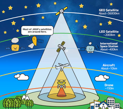
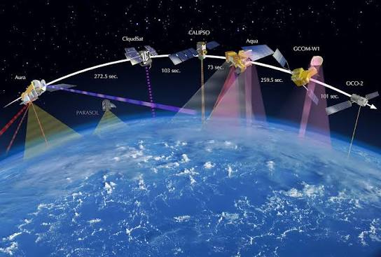
Orbiting hundreds to thousands of kilometers above the planet, Earth observation satellites collect detailed information about the atmosphere, oceans, forests, ice sheets, and land surfaces. Their data enables researchers to track environmental changes over time, improve climate models, and support governments in making informed decisions about climate action.
What Are Earth Observation Satellites?
Earth observation satellites are spacecraft equipped with specialized sensors and cameras designed to observe Earth’s surface and atmosphere. They gather information using visible light, infrared radiation, radar, and other sensing technologies.
Unlike satellites designed primarily for communication or navigation, Earth observation satellites focus on monitoring environmental conditions and natural processes. They provide continuous global coverage, making it possible to study remote regions that are difficult or impossible to access on the ground.
Monitoring Global Temperature Changes
One of the most important contributions of Earth observation satellites is measuring global temperatures. Satellite sensors record land surface temperatures, sea surface temperatures, and atmospheric conditions over long periods.
These observations help scientists identify warming trends, compare historical climate data, and better understand how greenhouse gases influence Earth’s climate. Continuous satellite monitoring also improves the accuracy of climate prediction models used by researchers worldwide.
Tracking Melting Ice and Rising Sea Levels
Climate change has accelerated the melting of glaciers, ice sheets, and polar sea ice. Satellites provide detailed images and measurements that allow scientists to monitor these changes with remarkable precision.
By tracking shrinking ice masses in Greenland, Antarctica, and mountain regions, researchers can estimate how much water is entering the oceans. Satellite altimeters also measure sea level rise, helping coastal communities prepare for future flooding and erosion.
Monitoring Forests and Deforestation
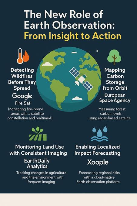
Forests play a vital role in absorbing carbon dioxide from the atmosphere. Earth observation satellites monitor forest health, detect illegal logging, and measure changes in vegetation cover.
Governments and conservation organizations use satellite imagery to identify areas affected by deforestation, wildfires, and disease. This information supports reforestation efforts and helps protect biodiversity while reducing greenhouse gas emissions.
Observing Oceans and Marine Ecosystems
The world’s oceans absorb much of the excess heat generated by climate change. Satellites measure ocean temperatures, currents, sea surface height, and chlorophyll concentrations that indicate marine plant growth.
These observations help scientists understand changing ocean circulation, coral reef health, marine biodiversity, and the development of extreme weather events such as hurricanes and cyclones.
Monitoring Natural Disasters
Earth observation satellites play a critical role in disaster management. They provide early warning information for floods, droughts, hurricanes, volcanic eruptions, and wildfires.
Real-time satellite imagery allows emergency responders to assess damage, coordinate rescue operations, and deliver humanitarian aid more effectively. Faster access to accurate information helps reduce the impact of natural disasters on communities.
Supporting Agriculture and Food Security
Climate change affects crop production through changing rainfall patterns, rising temperatures, and increasing droughts. Satellites help farmers monitor soil moisture, crop health, and vegetation growth throughout the growing season.
By providing early warnings of drought or crop stress, satellite data enables farmers to make better irrigation and planting decisions, improving food security while conserving water resources.
Measuring Greenhouse Gas Emissions
Modern satellites can detect atmospheric concentrations of greenhouse gases such as carbon dioxide and methane. These measurements help scientists identify major emission sources and monitor how emissions change over time.
Governments use this information to evaluate climate policies and track progress toward international environmental goals.
Challenges and Future Developments
Although Earth observation satellites provide invaluable information, they also face challenges. Launching and maintaining satellites requires significant investment, while processing enormous amounts of data demands advanced computing systems.
Future satellites will include higher-resolution sensors, artificial intelligence for faster data analysis, and improved international collaboration. These innovations will allow scientists to monitor climate change with even greater accuracy and speed.
Conclusion
Earth observation satellites have become indispensable tools in climate change research. They provide continuous, accurate, and global information that helps scientists understand environmental changes, improve climate predictions, and support sustainable development.
As climate challenges continue to grow, satellite technology will remain at the forefront of scientific research, guiding efforts to protect ecosystems, reduce greenhouse gas emissions, and build a more resilient future for generations to come.